Tag Archives: university

Dundee University press and YSE award

The computing department at the university of Dundee wrote a little article about after winning 3rd place at the Scottish young software engineer of the year awards.

Applied Computing Graduate secures 3rd Place in ‘Young Software Engineer of the Year’ Awards

Shortly after graduating this year with a BSc in Applied Computing, Stewart Taylor was awarded 3rd place at the ScotlandIS ‘Young Software Engineer of the Year’ awards.

ScotlandIS is a trade body for the ICT sector that represents approximately 200 technology and software related businesses in Scotland. The awards are allocated to computer science and software engineering students in Scotland, who completed exceptional undergraduate software projects.

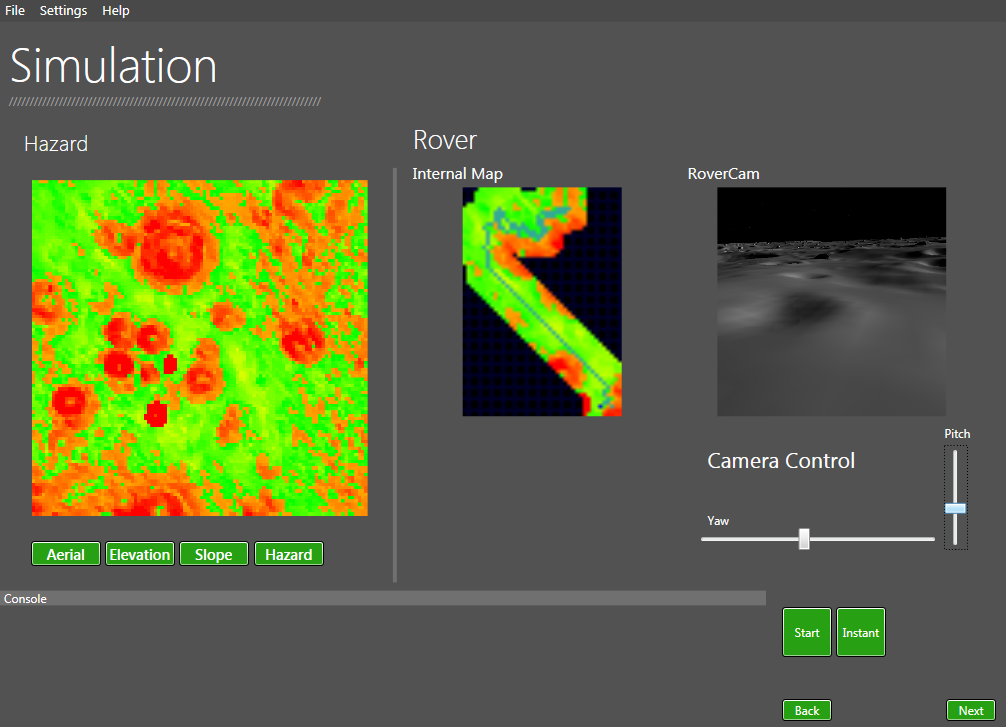
The University of Dundee nominated Stewart for his strong final year project. His project provided a visual demonstration of path planning which will be used by the Space Systems Research Group to showcase their work for outreach. Stewart’s portfolio of work includes a number of mobile phone applications, and games that he developed and published for the Xbox indie marketplace. We are delighted to hear the news of his success, particularly as Stewart was competing against nominees from 12 other universities.

Stewart gained a number of accolades whilst studying. As part of a team in 2012, he received 1st place in the ‘Yahoo! Hack Day Dundee’ competition, and he was awarded a medal for top student in Applied Computing Level 3. Stewart also recently participated in the ESA App Camp 2013, as one of 20 selected participants from across Europe. His undeniable academic success has led to a new and exciting career as a Software Engineer for ‘LoopUp’, a teleconferencing start-up based in San Francisco. His parents collected his award on his behalf as he was en route to his new life in North America.

http://www.computing.dundee.ac.uk/newsandevents/newsdetail.asp?1044


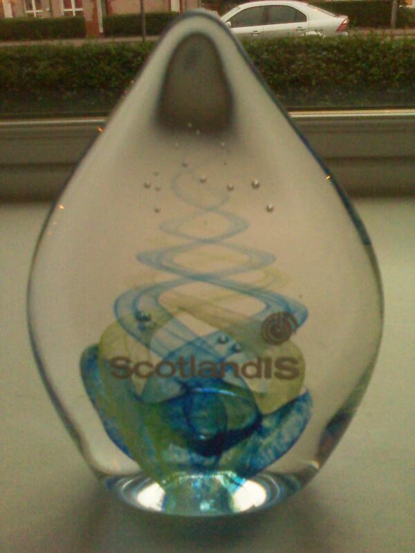
Winning the award got me this nice little trophy and a very generous cash prize. I could not attend the event however as it was taking place while I was actually on the plane to San Francisco.

BTGonapCYAEEOC7

http://www.scotlandis.com/news/stories/exceptional-students-lift-software-awards

Dynamic Pathfinding In Unknown Terrain

I have nearly completed my honours after many months of work. My initial idea was to keep this website updated with its progress but it was such a busy year I had very little time to do so.

The completed system uses the D star search algorithm and simulated planetary data from the University of Dundee’s space research groups PANGU system. The simulation runs in real time and it is possible to see the rovers map update in real time as well as being able to have a view of what the rover sees.

DPP INterface

The image above shows the rover safely traverse a 10485m² region. As the rover moves along it uses its simulated sensors to retrieve data about it’s environment. Using the D star search algorithm is it able to successfully make alterations to it’s current path on the fly without having to perform a brand new search. This saves a lot of time and is especially good with very large regions.

elevationCompare

The system can run comparison simulations using different path finding algoirthms and compare results.

Once I have completed my project at the start of May I plan to write up a section on this website which goes into detail about the project, how it works etc.I also plan to make a video of the system in action. The interface has a stage progression system which is kind of difficult to show in images plus it would be nice to be able to see the system working in real time.


Disparity Maps

For one of my university modules I was required to create Disparity Maps from stereo image pairs. I quite enjoyed doing this image processing as It was more enjoyable than the usual tasks I get given. I also got to use MatLab which I had never used before and actually quite enjoyed it, especially with all the quick features it includes.

Here is a few examples of what the project I was working on can do on a stereo image pair of the pentagon.


MatLab makes its fairly easy to plot 3D objects. Unfortunately however there is still some noise being picked up by the algorithm.

I will upload the code to GitHub at some point, It still requires a few tweaks however at the moment.

GitHub

Over the past few years I have been using Git for source control on my projects both personal and for university. I really enjoy using it and find it makes it much easier to manage larger projects and I think it would be useful if others can benefit from the code I have written as well.

My account is https://github.com/Stewart-Taylor

I’m also now hosting my Laser System on it, as people request the code for it frequently (Also feel free to use it in your own project no need to ask for permission).

3D Sailing Ship

For one of my graphics assignments I had to use make use of shaders  So I looked up fragment and vertex shaders and managed to complete this scene in 5 days. A vertex shader is used to adjust the vertex heights for the ocean. A fragment shader was also used for the texturing, sparkle ad gradient effects and I made a simple overlay shader the attempts to make the scene look more vintage.


Procedurally Generated Volcanic Island

For my second graphics assignment I had to make use of procedural generation techniques to create a scene. I decided that it would base mine around a volcanic Island , complete with water simulation and a particle generator.


The generator I created can produced some quite nice scenes. It could probably be useful in creating a Caribbean type environment populated with islands.

The smoke particles that are generated also get effected by the environment wind and the height of that particle. This provides a nice scattering effect for the smoke as it rises.

Honours Project – Dynamic Path Planner

I have been recently working on my honours project for my final year of university. The project is about using dynamic path finding algorithms to help autonomous vehicles navigate unknown terrain. The project is mainly focusing on developing the best navigation systems for ground space vehicles such as autonomous rovers that would navigate asteroids or planets.

I have completed my initial prototype which uses generated elevation models. These elevation models are loaded from a modified “ppm” format which uses the red and green values to provide 24 bit two dimensional arrays.

A slope model is then calculated using the specified slope algorithm (Horn Slope, maximum, average). This slope model is the converted to a hazard model which can be used for the rovers navigation.

The path finding part of the prototype makes use of the A star search algorithm. The simulation uses the algorithm to find the safest route to its destination. This means it will find the route with the lowest incline.

 The next prototype I create will be to develop a simulation which will make use of the D star search algorithm. This new prototype will be used to show the comparison of A star and D star when it comes to navigating unknown terrain.