Category Archives: Honours Project

Dynamic Pathfinding In Unknown Terrain

I have nearly completed my honours after many months of work. My initial idea was to keep this website updated with its progress but it was such a busy year I had very little time to do so.

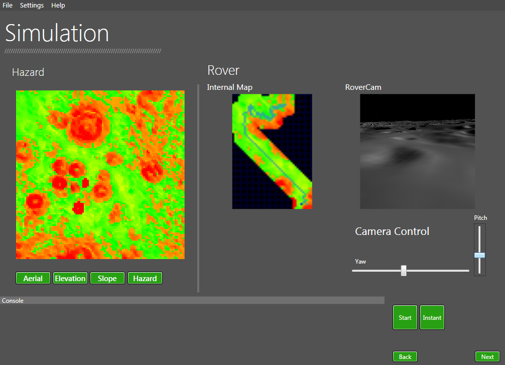
The completed system uses the D star search algorithm and simulated planetary data from the University of Dundee’s space research groups PANGU system. The simulation runs in real time and it is possible to see the rovers map update in real time as well as being able to have a view of what the rover sees.

DPP INterface

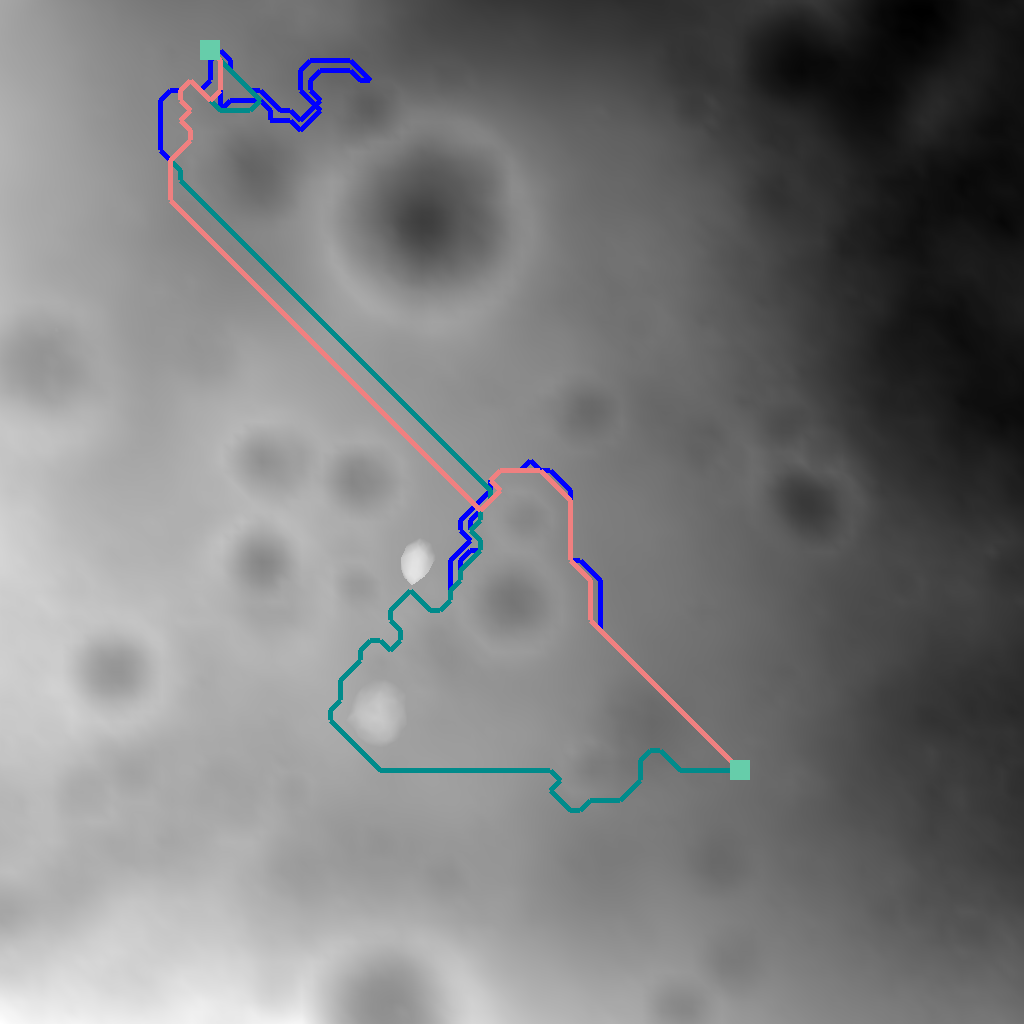
The image above shows the rover safely traverse a 10485m² region. As the rover moves along it uses its simulated sensors to retrieve data about it’s environment. Using the D star search algorithm is it able to successfully make alterations to it’s current path on the fly without having to perform a brand new search. This saves a lot of time and is especially good with very large regions.

elevationCompare

The system can run comparison simulations using different path finding algoirthms and compare results.

Once I have completed my project at the start of May I plan to write up a section on this website which goes into detail about the project, how it works etc.I also plan to make a video of the system in action. The interface has a stage progression system which is kind of difficult to show in images plus it would be nice to be able to see the system working in real time.


Honours Project – Dynamic Path Planner

I have been recently working on my honours project for my final year of university. The project is about using dynamic path finding algorithms to help autonomous vehicles navigate unknown terrain. The project is mainly focusing on developing the best navigation systems for ground space vehicles such as autonomous rovers that would navigate asteroids or planets.

I have completed my initial prototype which uses generated elevation models. These elevation models are loaded from a modified “ppm” format which uses the red and green values to provide 24 bit two dimensional arrays.

A slope model is then calculated using the specified slope algorithm (Horn Slope, maximum, average). This slope model is the converted to a hazard model which can be used for the rovers navigation.

The path finding part of the prototype makes use of the A star search algorithm. The simulation uses the algorithm to find the safest route to its destination. This means it will find the route with the lowest incline.

 The next prototype I create will be to develop a simulation which will make use of the D star search algorithm. This new prototype will be used to show the comparison of A star and D star when it comes to navigating unknown terrain.